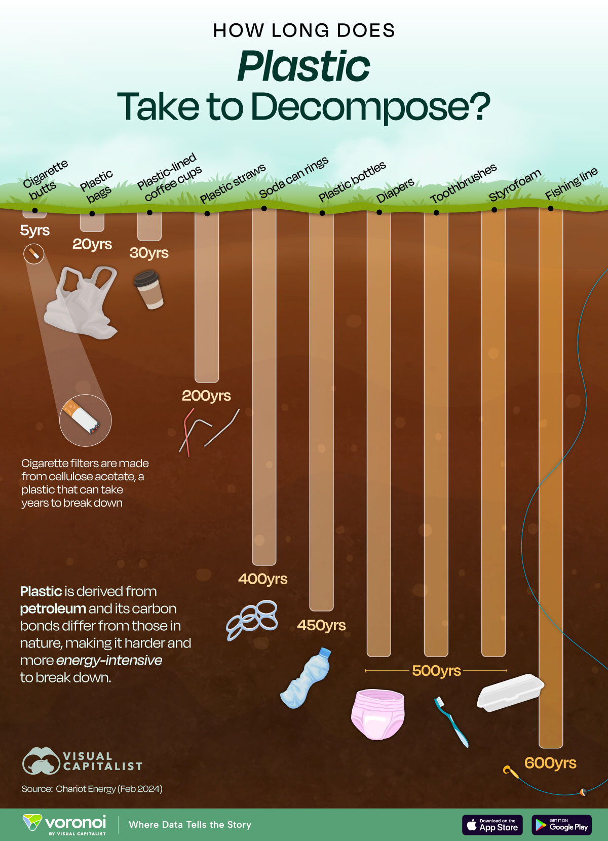
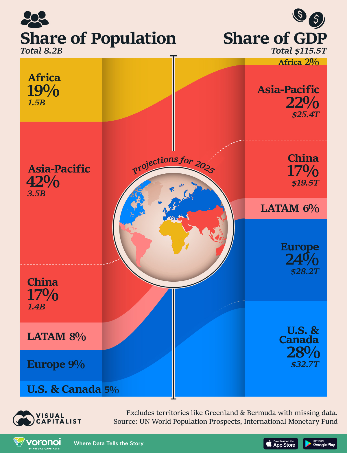
You are here
Environment
Mapped: How Much of the World is Covered by Croplands?
Click to view this graphic in a higher-resolution.
Mapping Cropland Cover Around the World
Over the last 50 years, the world’s human population worldwide has grown exponentially.
And this population explosion brought greater food production needs with it, through livestock breeding, cropland expansion, and other increases in land use.
Interactive Map: U.S. Property Taxes by State
http://datawrapper.dwcdn.net/wACf1/3/!function(){"use strict";window.addEventListener("message",(function(a){if(void 0!==a.data["datawrapper-height"]){var e=document.querySelectorAll("iframe");for(var t in a.data["datawrapper-height"])for(var r=0;r
Mapped: U.S. Property Taxes by State
Almost $600 billion in revenue was generated from U.S. state and local property tax revenue in 2020, a figure that has gradually risen over the last several decades.
Visualized: Per Capita Electricity Emissions, by State
Subscribe to the Decarbonization Channel’s free mailing list for more like this
Per Capita Electricity Emissions by State
This was originally posted on the Decarbonization Channel. Subscribe to the free mailing list to be the first to see graphics related to decarbonization with a focus on the U.S. energy sector.
Charted: Global CO2 Emissions by Income Group
Global CO2 Emissions by Income Group
From a historical perspective, the current demand for natural resources has surged to unprecedented levels and continues to escalate—for both essential needs like food, clothing, water, housing, infrastructure, and non-essential consumption in everyday life.
This surge has been accompanied by annual increases in CO₂ emissions. Consumption, however, differs radically depending on income.