In a territorial dispute spanning nearly two centuries, tensions between Guyana and Venezuela have once again reached a boiling point. The focal point of this dispute is the vast Essequibo region which encompasses around 70% of Guyana’s territory, and is roughly equivalent to the size of Florida.
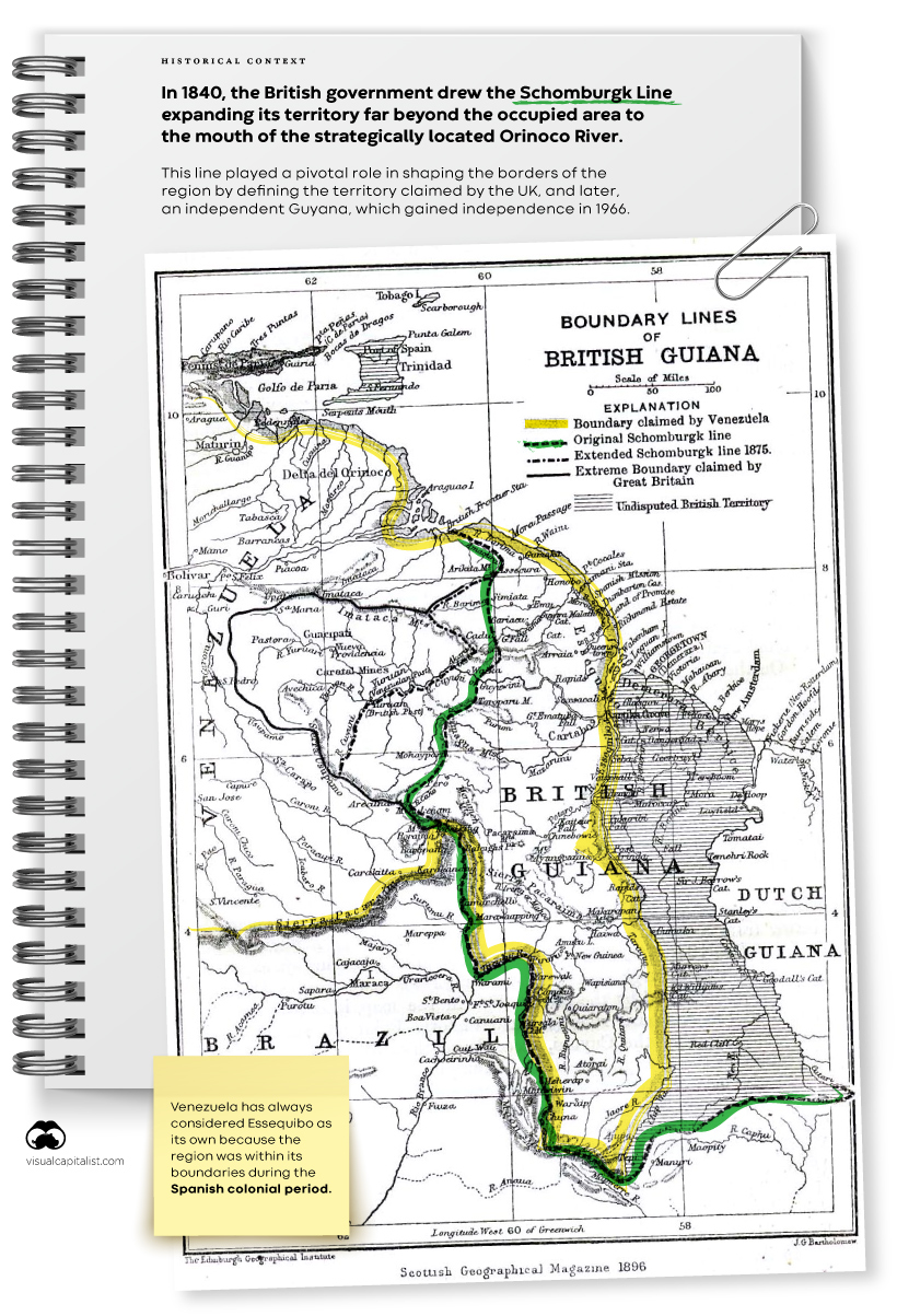
Venezuela claims historical rights dating back to the Spanish colonial period when Essequibo fell within its boundaries. In 1840, the British government drew the Schomburgk Line expanding the territory of British Guiana (now Guyana) far beyond the occupied area and to the strategically-located mouth of the Orinoco River.
Click to enlarge
This line played a pivotal role in shaping the modern borders of the region by defining the territory claimed by the UK, and later, a decolonized Guyana, as the country gained independence in 1966. That same year, Venezuela and the UK signed an agreement aiming for a negotiated solution.
In 2004, President Hugo Chávez eased border tensions under the advice of Fidel Castro, stating that he considered the dispute to be finished.
Recent events, however, have reignited the dispute. Between 2015 and 2021, Guyana announced the discovery of about 8 billion barrels of oil, elevating a country with fewer than a million people to a prominent position among the top nations in terms of oil reserves. ExxonMobil, leading a consortium, operates three offshore projects in the country, earning nearly $6 billion in 2022 alone.
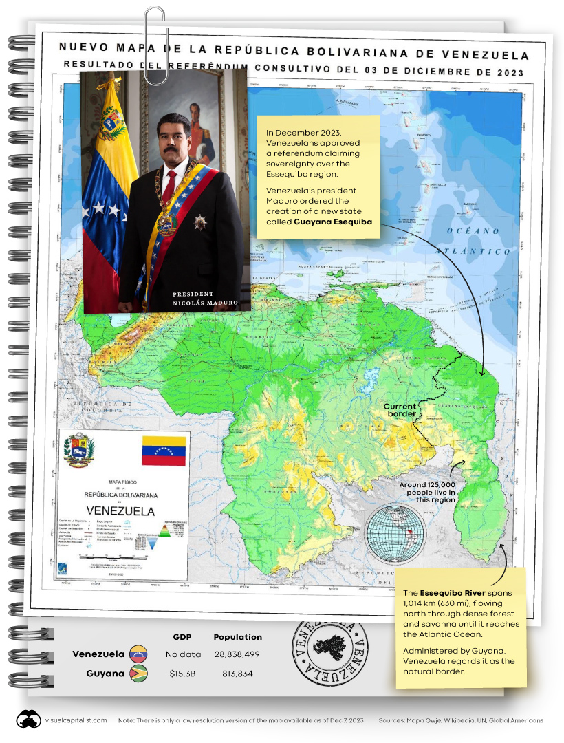
Venezuela’s Referendum and New Map
On December 1, 2023, the World Court ordered Venezuela to refrain from actions in the border dispute with Guyana. However, just two days later, on December 3, Venezuelans approved a referendum claiming sovereignty over Essequibo.

Click to enlarge
President Maduro subsequently ordered the creation of a new state, Guayana Esequiba, within Venezuela’s borders, and released a new map of the country.
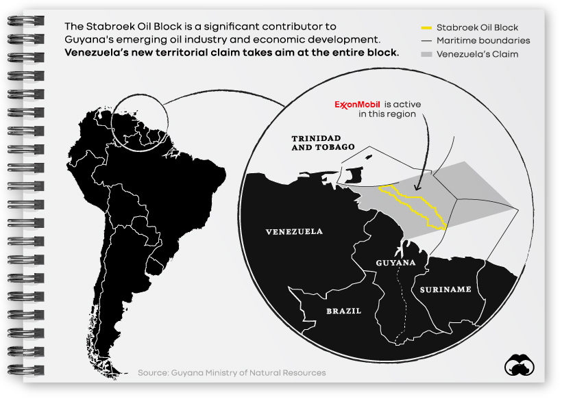
Venezuela’s new territorial claims don’t stop on land, they extend far out into sea as well. Specifically, Venezuela is claiming a critical area called the Stabroek Oil Block, where ExxonMobil and others are already active.

With a population of around 125,000 people, the disputed region is full of dense rainforest, making a military incursion from Venezuela feasible only by sea or through the Brazilian state of Roraima. Brazil, maintaining good diplomatic relationships with both countries, has already increased military personnel on the border. The U.S. announced joint military flight drills in Guyana on December 7.
Despite increased military presence in the region, many experts believe that President Maduro has no intention of actually annexing Essequibo, and that this recent claim is a tactic to bolster his own image within Venezuela.
The post The Venezuela–Guyana Dispute Explained in 3 Maps appeared first on Visual Capitalist.