You are here

Florida

OpenCalais Metadata: Latitude: 
28.0908069444
OpenCalais Metadata: Longitude: 
-81.960407533

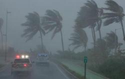
Over Half Of Florida Without Power As State Braces For "Lengthiest Restoration In US History"
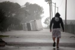
Over Half Of Florida Without Power As State Braces For "Lengthiest Restoration In US History"

Update (8:00am ET): As it travels over the Florida Panhandle, Irma has been downgraded to a tropical storm. Yet it continues to produce some wind gusts that are near hurricane force.


* * *

Elon Musk Magically Extends Battery Life Of Teslas Fleeing Irma

Elon Musk Magically Extends Battery Life Of Teslas Fleeing Irma

In what is either a generous act of charity or an unnerving example of the control Tesla exercises over the vehicles it producers, or perhaps both, Tesla CEO Elon Musk has magically unlocked the batteries of every Tesla in Florida to maximize the distance that people fleeing from Hurricane Irma can travel before stopping to refuel at one of the company’s “superstation” charging centers.

Typically, these types of over-the-air upgrades can cost thousands – if not tens of thousands – of dollars.

The Looting Begins...

The Looting Begins...

Via StockBoardAsset.com,

WPLG in Fort Lauderdale, Florida has just released footage of 8-9 looters targeting a Simon’s shoe store on Sunrise Blvd. and Powerline Road.  

In the video, the store’s front windows are smashed in with a nearby ladder laying on the ground. Various members of the group are seen running in and out of the store with stolen goods.

Per WPLG, 

Irma's 15-Foot Storm Surge Could Demolish 1,000 Miles Of Florida Coast: "It Will Cover Your House"

Irma's 15-Foot Storm Surge Could Demolish 1,000 Miles Of Florida Coast: "It Will Cover Your House"

As we noted on Friday, sea-level analytics firm Climate Central had created a simulation based on the National Hurricane Center’s Coastal Emergency Risks Assessment storm surge and wave modeling that illustrated the devastating flooding in Miami that could result from Hurricane Irma’s storm surge. By overlaying the NHC data with a three-dimensional visual of the city obtained using Google maps, the firm created a realistic visual of what the city would look like under between seven and 11 feet of water.

Pages